

Introduction
Site list (GPS fixes) Walks (GPS tracks) Video clips Panoramas
Electronic projects:
Bat detector
Lamp tests
µ-controlled lamp
SEPIC-based lamp
ISP isolators
Making SMT boards
Expedition logs:
Spain 1973, 1974,
1975, 1976, 1977,
1979, 1982, 1983,
1985, 1986, 1987,
1988, 1989, 2000,
2001, 2002, 2003,
2004, 2005, 2006,
2007, 2008, 2009,
2010, 2011, 2012,
2013, 2014, 2015,
2016, 2017, 2018,
2019, 2020, 2021,
2022, 2023
Mexico
New England
Translation:
Name: Cueva Negra
Location: Llovio valley
GPS: N43°25'21" W5°00'27" (Alt. 439m)
UTM: 30T 337.60 4809.90
Lambert: 4933 9808
Map: Ribadesella? (31-?)
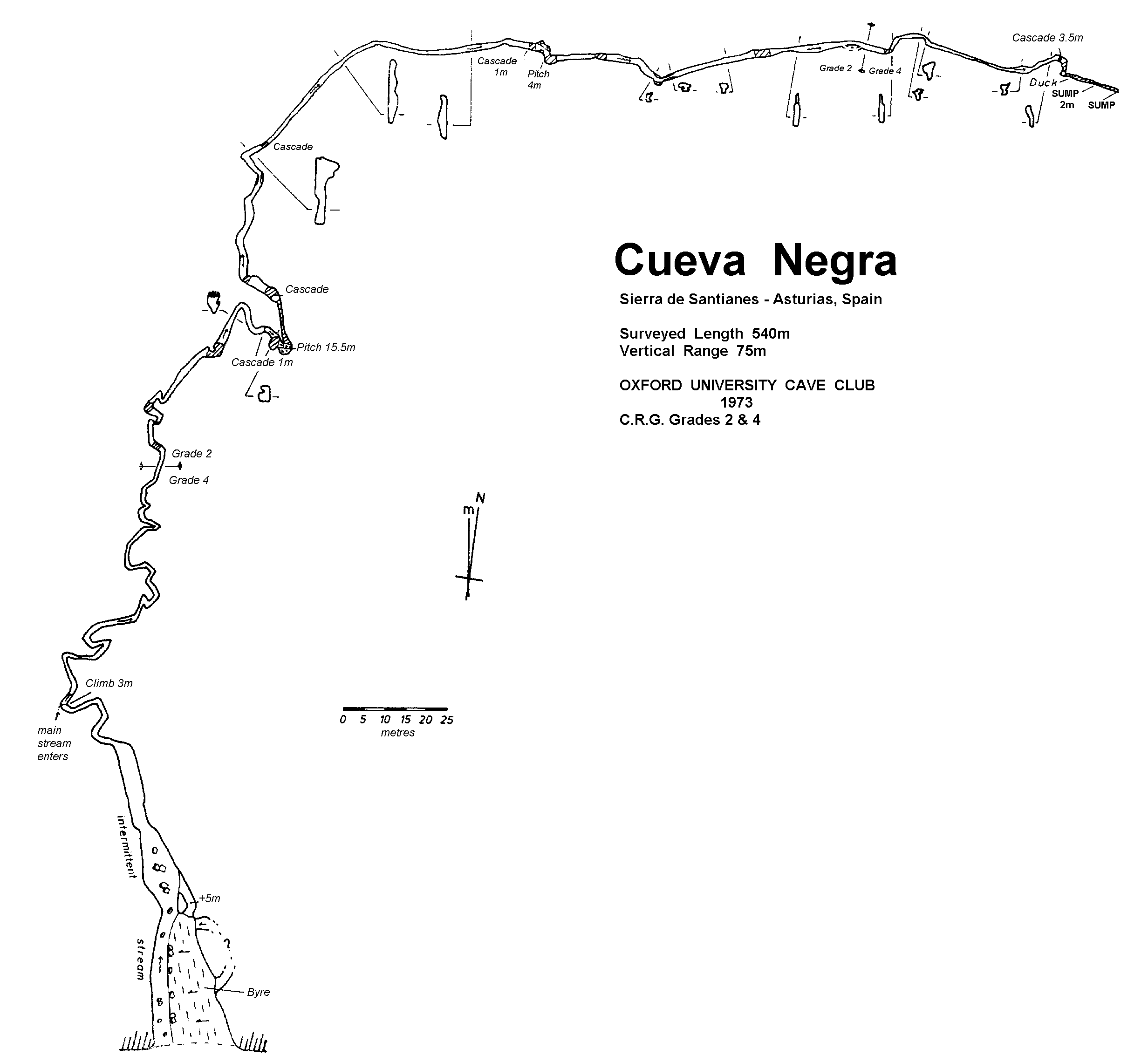
Description: OUCC (Ann Morrison): “The cave consists of vadose development along the line of a fault. There is a fairly regular orientation of the streamway which follows the simple linear structure of the fault closely. The average width of the passage is from 1 to 2m, the height varying between 2 and 7m. Occasionally one had to crawl below or squeeze past curtains hanging from the walls, but it was usually possible to walk upright. There is one free climb before the pitch which is followed by another of about 2m. The pitch marks the limit of the 1972 preliminary expedition and descends l5m, with a small waterfall flowing over it into a very shallow pool. After the pitch, the passage continues with little change from its previous character, though its rift-like nature becomes gradually more discernible. The cave terminated in a very narrow rift with 2, or more, metres of water.”
See OUCC Proc. 7 » (survey should be at http://www.oucc.org.uk/procs/proc07/negra3.gif but is missing, so copied here).
Visits:
1973 – Bill with OUCC?
1975 – to 15m pitch (returned through Tinganón)
1986 – to main pitch; fun with cowsh
2003 – to 3m pitch, investigated Tinganón feeder, looked for resurgence
2009 – to 3m pitch, thwarted again